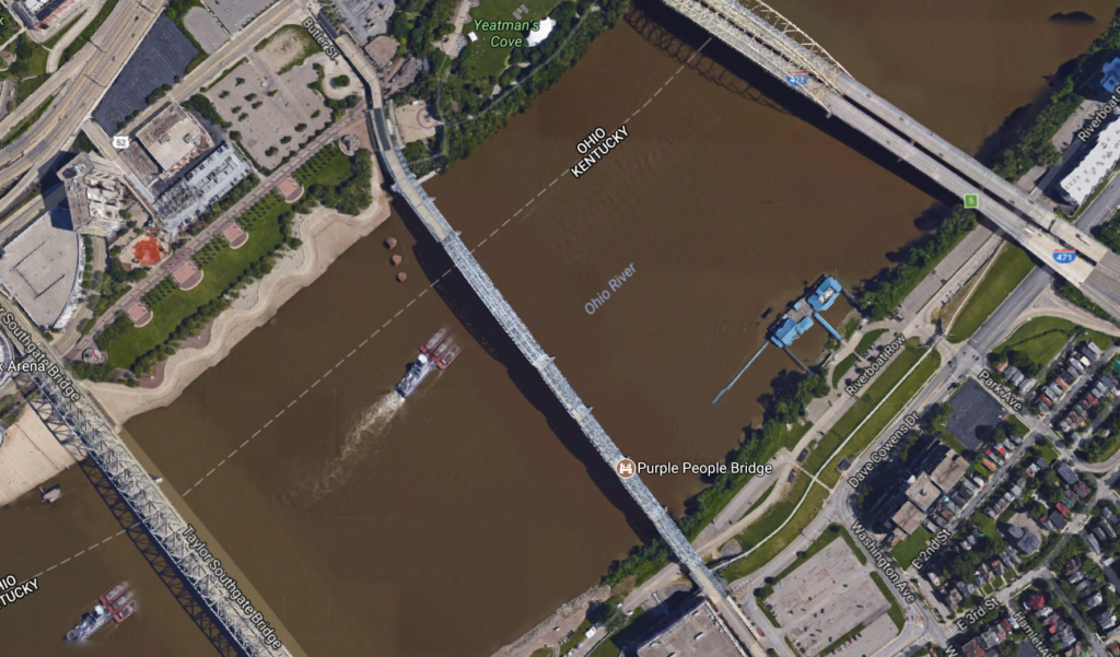
A bridge that connects two states and one nation
Where Blue (the North) and Gray (the South) come together to create The Color Purple – the Purple People Bridge
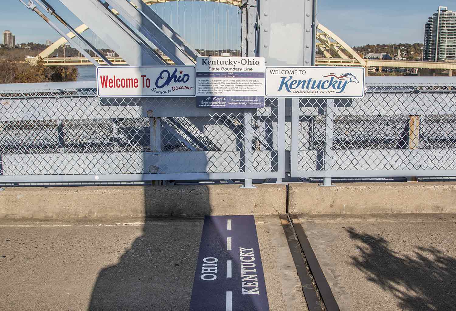
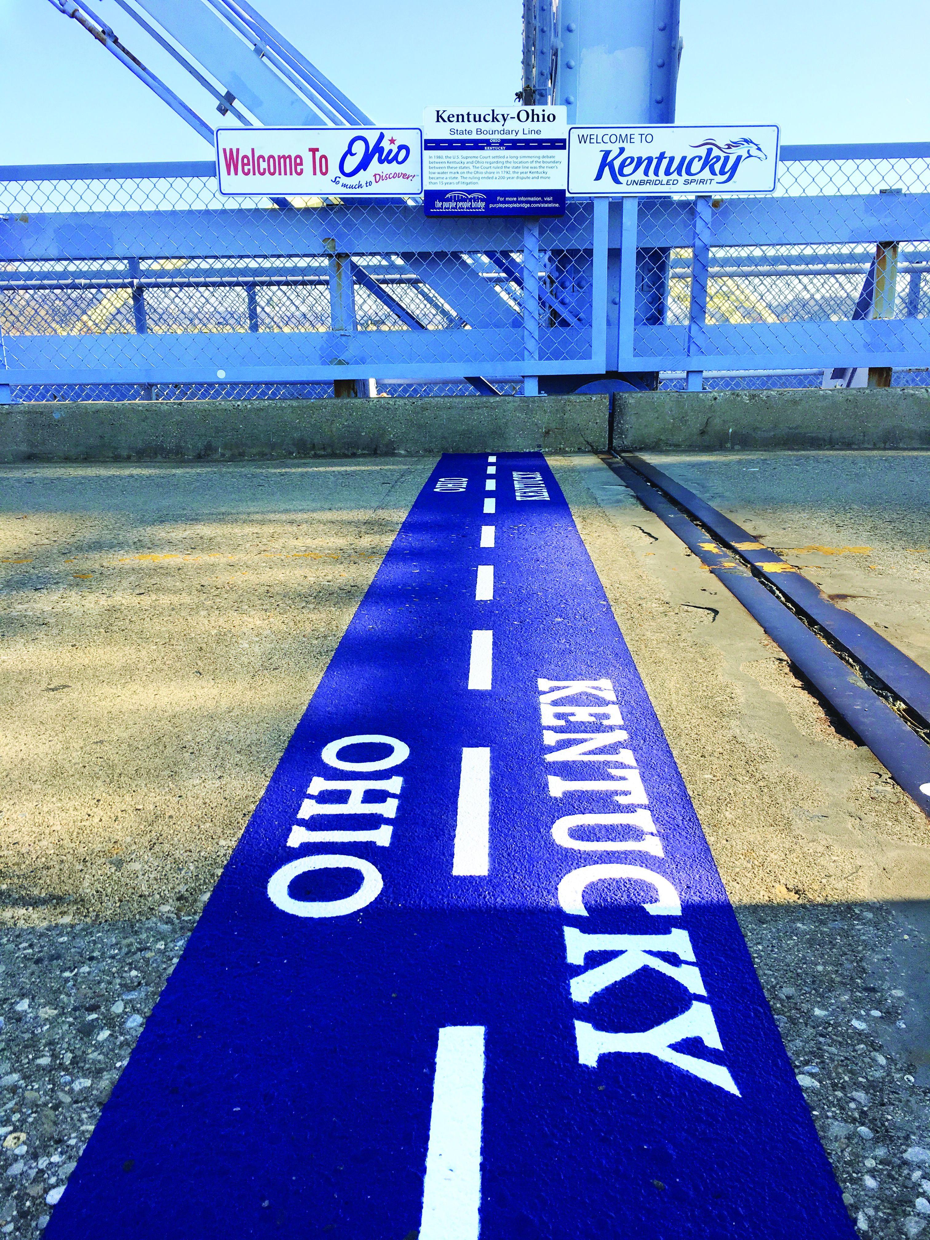
Cross the Kentucky-Ohio border that took nearly 200 years to resolve
The border that separates Kentucky and Ohio, which can be seen on the Purple People Bridge, has a long and complicated history.
In January 1980, the U.S. Supreme Court settled a long-simmering debate between the Commonwealth of Kentucky and the States of Ohio and Indiana about where this boundary line should be located.
 For many years, Kentucky claimed that the entire river belonged to the Commonwealth, and as a result, Kentucky received nearly all revenue from fishing, boating, liquor, and other licenses granted for use on any portion of the river.
Ohio and Indiana disagreed. They argued the border should be the Ohio River’s northern shoreline as it existed in 1792, the year Kentucky became a state. Because the river level was raised as a result of dam construction and other factors, they claimed that the boundary line was actually somewhere near the middle of the river.
In January 1980, the Supreme Court ruled that the boundary between the states should in fact be the low-water mark on the Ohio and Indiana shore in 1792 and directed that the three states to figure out exactly where that boundary line was located. The ruling ended a nearly 200-year dispute and more than 15 years of litigation between the states.
The United States Geological Survey used data from two surveys conducted by the U.S. Army Corps of Engineers from 1896 to 1914 to help establish the 1792 low-water mark.
 Under the agreement reached by the states, the boundary varies along the Ohio and Indiana shoreline. In some places, it hugs the shoreline less than 100 feet from the shore and in other areas it extends to than 500 feet from the shoreline.
Built seven years after the Civil War, the Purple People Bridge is where the Blue (the North) and the Gray (the South) come together to create The Color Purple. It’s not the Mason-Dixon Line or the Missouri Compromise Line, but it is the boundary line that separated the North (free states) from the South (slave-holding states) prior to the Civil War.
Visit the Purple People Bridge, where you can stand in both Ohio and Kentucky at the same time by straddling the boundary line while enjoying a panoramic view of Cincinnati and Northern Kentucky skylines. And don’t forget to post a photo of your feet performing this feat on social media.
And if you want to learn more about the history of our region and about some of the heroes who served as conductors on the Underground Railroad, then visit the National Underground Railroad Freedom Center, which is just a short walk along the river in Cincinnati from the Purple People Bridge.